
Title: | The Roads of Ewyas Lacy |
Date: | 2022 |
The Roads of Ewyas Lacy
By
Bob Steele
INDEX
Ewyas Lacy possesses a maze of roads, lanes, tracks and footpaths in which, even in these days of satellite navigation systems, it is still easy to get lost. Many of our lanes meander for no apparent reason, some appear to lead nowhere in particular, others tail off and become ever narrower with worrying amounts of grass growing down the centre. There are ?green lanes?, hollow ways, drovers? roads and unsurfaced tracks, once apparently important but now rarely visited, and footpaths whose origin, purpose and destination are sometimes far from obvious. Together they all tell the story of this area and its people from ancient times to the present day. This paper aims to cast light on that story in the context of wider forces that also helped shape our past.
In early times population was sparse, most land was covered with woods or scrub and people just went from place to place across the open land by routes that offered the easiest passage, avoiding natural obstacles and taking advantage of useful natural features such as river fords. Such farming as existed was at the subsistence level and the produce was consumed by the farmer and his family on the spot or was commandeered locally to meet the demands of the Lord of the area. Either way traffic was mostly within the immediate locality on foot or by horseback and wheeled transport was rarely used, which meant there was little need for roads or surfaced track-ways. Those longer journeys that did take place frequently followed 'ridgeways' along the high ground, to avoid river valleys that were often poorly drained and marshy.
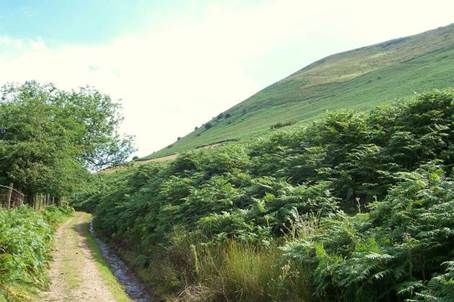
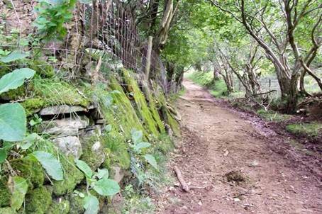
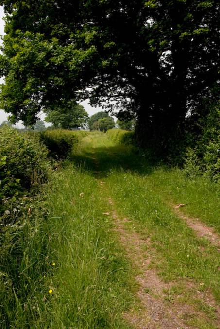
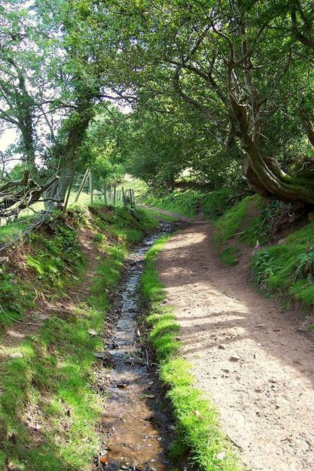
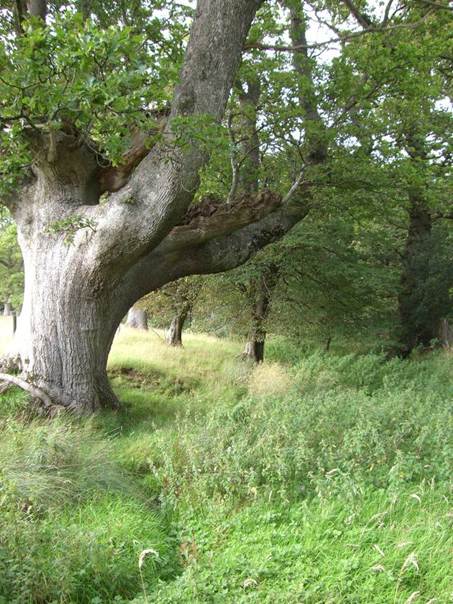
George Charnock in his paper on Paths and Tracks in Newton explains how these direct cross-country routes were the forerunners of later footpaths, lanes and roads that evolved in Ewyas Lacy as people chose to follow established routes rather than find their own way. However, as settlement patterns changed over time some faded away and were lost. Some survived merely as footpaths, bridleways, drovers' roads once used to drive livestock to market or as largely disused 'green lanes' or hollow ways that can still be found in many parts of Ewyas Lacy.
|
|
|
| Drovers road on the Hatterall Ridge | Unsurfaced track near Longtown |
|
|
|
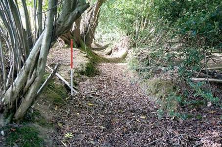
| Green lane in St Margarets | Footpath and Bridleway near Longtown |
|
|
|
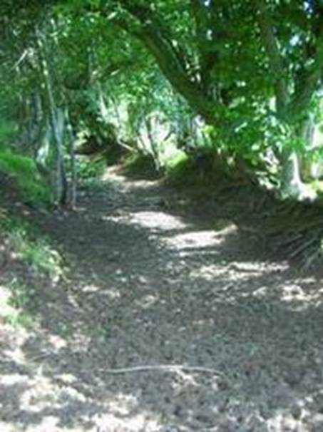
| The Cefn Road - a disused Ridgeway | Sunken track or ' |
|
|
|
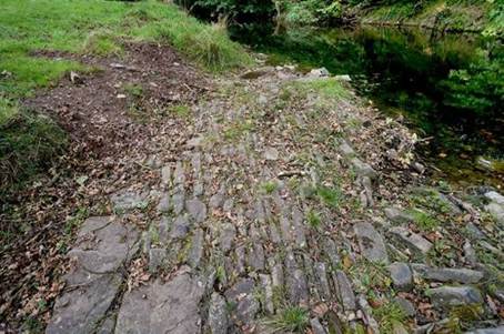
| Stone lined ford on a disused track | Sunken Footpath in Ewyas Lacy |
The rest of the early tracks would develop into the network of local lanes and roadways that make up the bulk of
The Romans built a network of military roads across
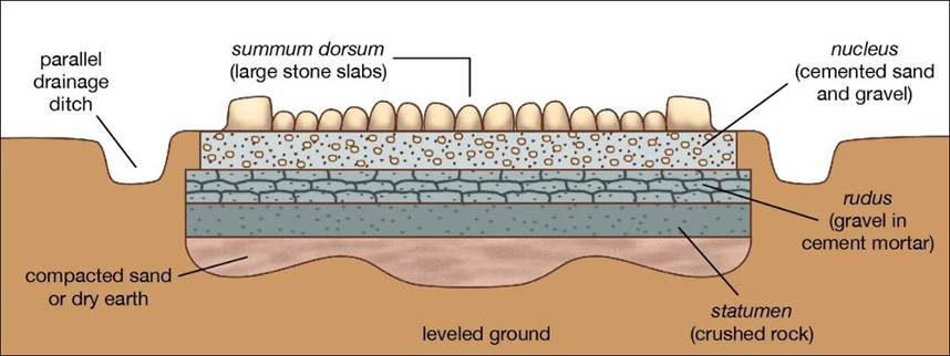
The primary function of Roman roads was to allow the rapid movement of troops and military supplies, but they also provided vital infrastructure for trade and the transport of heavy goods in all weathers. Roads were classified in order of importance. The important roads were viae publicae (public roads). These could be over 40 feet wide and were built to the highest standards with ditches, curbs and a multilayered structure with gravel or stone surfacing. Secondary roads were viae militares (military roads) built and maintained at the expense of the army, and these could be as little as 12 feet wide [just enough to permit two chariots to pass] and in some cases amounted to little more than stones set directly on the levelled ground surface with barely visible lateral ditches to provide drainage. Local roads (actus) , and finally privatae (private roads) were built and maintained by the landowner.
Roman roads were generally laid out in a straight line and even when obliged to divert around ridges, rivers or valleys were still usually laid out in straight lengths rather than curves. The main roads consisted of three layers:
- A bottom foundation layer, often of stone
- A middle layer of softer material such as sand or gravel
- A surface of gravel consisting of layers of finer material with a total thickness of between 2-3in (5-7.5cm) and 1-2ft (30-60cm), sometimes cemented and topped with paving stones
The total depth of a road, from surface to the bottom of the base, could reach one to one and a half metres sloped to each side from the centre for drainage and most were defined by curb stones on each side.
|
|
| Structure of a Roman public road [from Encyclopaedia Britannica] |
In and around Ewyas Lacy Roman roads were few but their presence can be seen in places and deduced elsewhere. At Longtown, investigations led by Longtown and District Historical Society and Herefordshire Archaeology have revealed that there was a small, first-century Roman fort thought to have been constructed during the Silurian campaign of 47-78AD. As the army advanced westwards territory gained was consolidated by the building of forts, which were typically placed within a day's march of each other to ensure that they could be both readily resupplied and quickly reinforced in the event of attack. The known forts at Abergavenny, Longtown and Clyro are broadly in line with this spacing, implying that there was at least a military road linking them through the heart of Ewyas Lacy, although evidence of the exact route has yet to be established. At Longtown no Roman artefacts have ever been found outside the area of the fort, so it appears that it was probably a purely military site and that the road to and from it would have been at best a secondary route not constructed to the more exacting standards of the public highways. The Romans appear to have abandoned the fort there by the middle of the second century and the remoteness of the area makes it likely that the road rapidly fell into disrepair and was lost thereafter.
Elsewhere it can be inferred for similar reasons that the known Roman road of
|
|
|
| Roman roads in and around Ewyas Lacy: Map courtesy of Longtown and District Historical Society and Herefordshire Archaeology | |
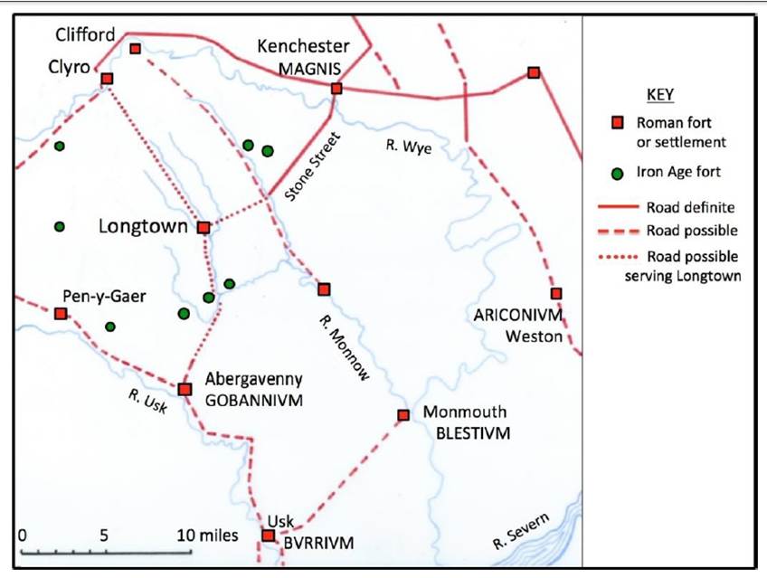
According to studies published in 'Herefordshire through time' on the Herefordshire Council website the course of the Roman road at Stone [or Stoney] Street ran past Eaton Bishop and over Worm Hill and Brampton Hill to Abbey Dore in the Golden Valley, where a section of the Roman road surface was revealed in the railway station yard in 1893, 18 inches below the surface. It is described as being 13ft wide, pitched with pieces of limestone larger than a man's head and with two distinct wheel tracks 4ft apart. The stone surface was not cemented, however, nor did the structure comply with the exacting standards of a public highway so again if Roman this would have been a secondary or temporary military road. The further course of this road is uncertain, but it is suggested that it ran past Ewyas Harold, Llancillo and Walterstone, where there is a Roman villa, and from there it most probably headed due south to the Roman town of
On the same website an essay by Mike Brown also suggests the existence of a Roman cavalry patrol route adjacent to Ewyas Lacy through the
Apart from the decaying survivors from Roman times, Medieval 'roads' were often the same more or less well-trodden paths across open land, hills and forests dating back to the pre-Roman era and created by local people as the easiest ways between dwellings, communities or other points of importance to them. They weren't surfaced, fenced, signposted or even maintained other than by the passage of travellers, and there were no maps so it was easy to get lost. Travellers were well advised to hire a guide, and in bad weather such roads quickly deteriorated into muddy quagmires and became passable only with great difficulty if at all.
|
|
Nevertheless, a wider network of more substantial roadways gradually developed as towns and settlements became established and trading of goods and services continued to grow. Sheep and cattle had to be walked to market, sometimes along 'drovers roads' that evolved for the purpose as the demands from town dwellers for meat, hides and wool increased, but also along ordinary roads where slow-moving herds of animals caused blockages and did at least as much damage to the surface as carriage wheels, not to mention the droppings they left in their wake. Growing economic activity also created new demands for a range of items such as building materials from distant quarries and forests, and for commodities such as flour from corn mills and other agricultural products to be taken to market. This in turn increased the need for roads to link the sources of these goods with market towns as well as with harbours where ships could be used to move goods onwards to distant destinations more easily and cheaply.
|
|
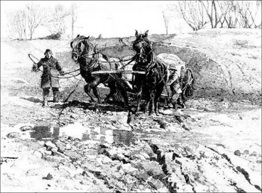
However, since it was nobody's job to construct a road - they existed simply because people chose to use that route - the unsurfaced highways were generally badly rutted and full of pot-holes. This made them dusty and difficult when dry, but in the wet they become muddy swamps. In the absence of hedges or fences tracks often got wider and wider as later travellers sought to find ways around the worst sections irrespective of the rights of adjacent landowners. It was generally accepted that wheeled vehicles could not use the roads during the worst four or five months of the year and for the same reasons farmers frequently didn't try to move their animals to the towns at those times either.
Despite these difficulties reasonably rapid long-distance travel was possible, if not commonplace. In 1066 King Harold marched his army from
Even elsewhere travel and the movement of goods didn't stop altogether in the winter months, of course. Packhorse trains remained an important mode of transport and could move in any weather.
|
|
|
| A Pack Horse Train | |
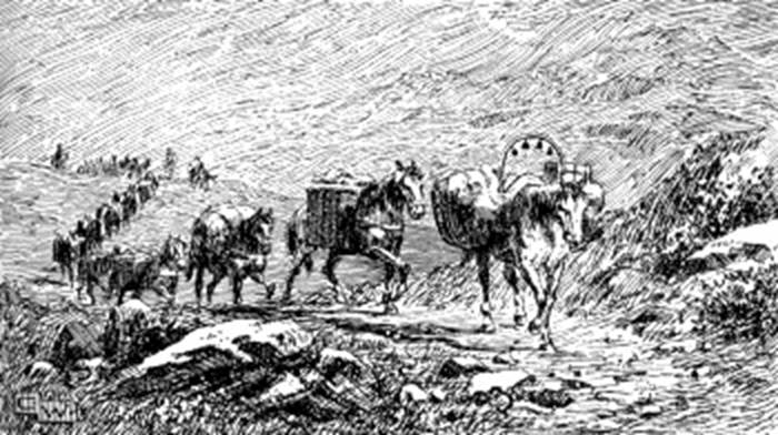
In some places their importance was such that special bridges [too narrow for a horse and cart] were built for them, some of which still survive. Where it was more convenient for the packhorses to use an existing road, it was common practice to make an all-weather track for them along the side, out of the mud. These causeways can sometimes still be seen beside modern roads
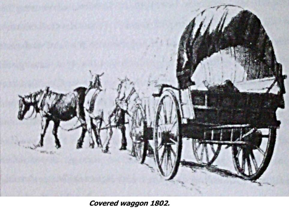
It took around ten horses to carry a ton, but they could move surprisingly quickly carrying lead, wool, coal, hides, iron and a huge range of manufactured goods around the country. But when the state of the roads would allow, it was much more efficient to transport the goods by horse-drawn wagon than by packhorse.
|
|
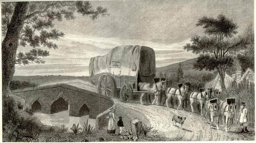
A team of eight horses hitched to a wagon could in theory shift the same load as thirty packhorses, although even as late as the 18th century most roads were so poor it was often alleged that that a blind person could move faster than wheeled vehicles.
Off the primary highways personal travel also continued to be possible on horseback even during bad weather, either across country for the adventurous or by picking one's way carefully through the worst of the mud on the local roads. Either choice remained a chancy business, though, with a high risk of a stumble or fall and little certainty about when [or even if] a journey of any significant distance would be completed. For most people, however, this was a time when long-distance travel was the exception rather than the rule; the majority were born, lived and died within their local community and so were little troubled by the state of the roads to more distant places.
Navigable rivers were a vital means to move material in bulk and, flooding apart, were rather less vulnerable to bad weather but were few and far between. As the volume of goods traffic rose, it began to make economic sense to try to improve the rivers, despite the objections of the fishermen, by introducing weirs and locks and sometimes digging special canals when the rivers did not run where they were needed. The Wye at Hereford was the subject of a number of such improvement schemes over the centuries but with limited success, and these efforts had little effect in mitigating the increasing pressures on the road infrastructure. In Ewyas Lacy watercourses were in any case too steep and shallow to offer any practical alternative as a means of transport.
By the 14th century, pavage grants, which had previously been made for paving the market place or streets of towns, began to be used for maintaining some of the more important roads between towns. These grants were made by letters patent, almost invariably for a limited term, presumably the time thought likely to be required to pay for the required works. In practice however responsibility for the upkeep of most roads rested with landowners. This duty was not easily enforced and little was done until the growing economic and social pressures of the Renaissance in
Ewyas Lacy was no exception to this rule. After the thirteenth century the Lordship was divided and for most of the time was in the hands of absentee landlords who received modest or no income from it and cared little about the people or the roads in such a remote and insignificant part of their domains. The local tenants and gentry had no time or money to spare for roads either; local estates were largely self-sufficient and bar occasional forays into markets in Longtown, Hereford or Abergavenny their travel tended to be on horseback and limited to their village church and the occasional social visit to near neighbours.
|
|
Estate workers too had limited horizons - trips to the nearest forest. corn mill or quarry were exceptions to the daily routines of animal husbandry and farming of the land. Even the collection of rents was a haphazard affair because of the parlous state of the roads; an account of such a journey in a letter by Mr Bartholomew Haselden as late as 1774 complains at length of the difficulties of calling on tenants in Newton and St Margarets along 'such roads it was at times doubtful whether Mr Higgins and I stayed there for the evening or not'.
However, other powerful forces were at work influencing the development of roads and tracks. Monastic activity was a key driver in the development of new routes across the countryside during the medieval period. This was a time of strong religious belief, but also one where sins were egregious and frequent amongst the rich and powerful. The Medieval Lords squared this circle by founding religious houses and making extensive grants of lands and tithes to them in the belief that their charity and the prayers of the grateful monks would earn them absolution. In and around Ewyas Lacy, research by Eddie Procter into Llanthony Priory describes how these far-flung estates or 'granges' often spanned large areas. Their management therefore required a network of roadways for the movement of stock and people, and for the transport of produce and supplies to the monasteries and settlements. The monks were also influential and well-connected, and so were well placed to negotiate such rights of way to link-up their scattered holdings.
|
|
|
| Speculative medieval network of routeways around Llanthony Priory [Procter] | |
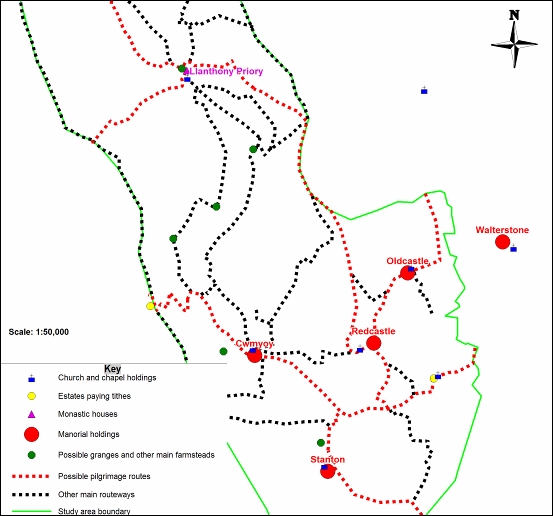
Monastic houses also became an important focus for religious, political and commercial matters. This required the regular movement of monks, officials and other travellers and thus created corresponding networks of roads and paths between them. The travellers included pilgrims; in the Middle Ages one of the major reasons for people to move about the countryside was to visit shrines and other religious sites connected to saints, and monasteries often served as hosts for such visitors. Most churches and monasteries claimed to possess relics that could cure many ills and this was a significant source of income for them. The wider commercial interests of the monasteries generated traffic too; many of them became very wealthy from their endowments, which combined with their religious status gave them substantial political influence. On all these counts plenty of people were anxious to call on them.
There were three main monastic centres influencing developments in Ewyas Lacy; the Cistercians at Abbey Dore in the Golden Valley, the Augustinians at Llanthony Priory in the Vale of Ewyas and the Grandmontines at Craswall Priory . These generated many routes around the area linking them with each other, their various holdings and the settlements that dealt with them. An interesting example of the latter is the pathway over the Hatterall Ridge from Llanthony to Longtown known as 'Rhiw Cwrw'.
Rhiw is the Welsh word for the stony paths that climb diagonally up the hillsides from the valley settlements and farms to connect to the ancient ridgeways. Cwrw is Welsh for 'ale' or beer, and Rhiw Cwrw is reputedly the pathway by which the beer brewed by the monks of Llanthony was brought to the castellan, garrison and burghers of Longtown, who were most likely amongst their best customers. The path certainly had special importance locally - Nina Wedell's research paper on the Clodock Church Estate reveals that, unusually, it is even named in medieval documents as forming part of the defined estate boundaries and it is still marked by name on Ordnance Survey maps today.
Elsewhere in Ewyas Lacy yet more tracks developed for pilgrims to the local parish churches. The churches each had their own saint with a following that drew visitors. One of the more popular destinations was Clodock, where the miracle of Saint Clydawg the Martyr proved a potent attraction, and even the lesser known Saint Bueno had enthusiastic supplicants at his remote church in Llanveynoe.
If the monastic houses were one of the main reasons for the development of a network of new routes in Ewyas Lacy during the medieval period, so their dissolution was a major factor in the subsequent decline or disappearance of many of them. Tracing the origins, routes and underlying logic of ancient roads and trackways is often a difficult task, but the remaining complex patchwork of paths, tracks and rights of way we see on Tithe and Ordnance Survey maps of Ewyas Lacy can more easily be interpreted and understood in the context of the religious centres of the time.
Despite the changing times and freer attitudes to travel of the emerging Renaissance at the beginning of the sixteenth century central government remained reluctant to take action to improve roads, seeing the matter as still a local problem. However, other pressing issues intervened. The Act of Supremacy of 1534 separating the Church of England from Roman Catholicism raised the real possibility of civil war between the religious factions as well as the possibility of invasion by Catholic forces from
The Surveyors would announce, on the first Sunday after Easter, four chosen days before 24 June on which the maintenance work was to be carried out, and for these four days the whole parish was to work on the highways. Every person who held land in the parish was to provide a cart or wain equipped for the work, and two able-bodied men, on a penalty of 10 shillings per occasion; the Surveyors could, at their discretion, require a further two men instead of the cart. Every other householder, as well as every other cottager and labourer was to come themselves or send a substitute able-bodied labourer to work for the four days, on a penalty of 12 pence per day apiece. All labourers were to provide their own equipment, and were bound to work for eight hours each day on the roads.
|
|
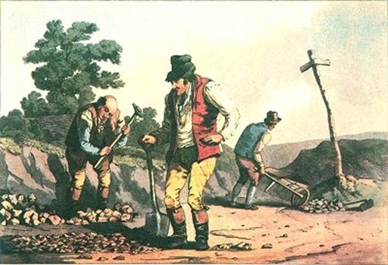
In this way each parish was simply commanded to keep its own roads in good repair, and left to get on with it. It had been normal under the centuries old Manorial system for every man to spend part of his time working on his lord's land, and for holders of land to provide men and service to the Crown when required, so delegating responsibility in this way must have seemed a natural thing to do.
The rules laid down by government were fair enough in theory. In practice however they meant that the Surveyor had to persuade the major landowners in the district to spend their own time and money on making good the highways. If they refused, he could take them to court, but since they were neighbours, friends and leading figures in the community this rarely happened. In any case, the Surveyor typically had no knowledge or experience of road-building and was well aware that in twelve months' time it would be somebody else's problem, so most considered that they had done their duty if they rode around the parish two or three times a year. If a section of local road became bad enough to inconvenience the local gentry they might do something about it, but this arrangement proved nearly useless for the principal highways that were used by long-distance travellers and waggoners.
During the 17th century as trade continued to increase, the inertia of the parishes and growing numbers of heavy carts and carriages led to serious deterioration in the state of the main roads.
|
|
A parliamentary bill had been tabled in 1621/22 to relieve the parishes responsible for part of the
|
|
| Carrier's wagon with wide wheels [Alamy] |
Many parishes continued to struggle to find funds to repair major roads and the unfortunate people nominally responsible sometimes found themselves on trial at quarter sessions for their failure to keep roads in good order. In 1656 a parish in desperation petitioned their local sessions for help to maintain their section of the
Not much is known of how the parishes of Ewyas Lacy dealt with their road maintenance obligations at this time. However, the relative remoteness and poverty of the area and the lack of significant through roads suggest that much of the debate probably passed the area by and that little was done.
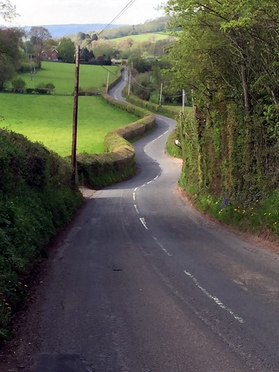
Alongside the above developments during the 17th century there was a marked acceleration of a traditional practice of landowners acquiring and enclosing common land by obtaining an Act of Parliament. These early enclosures often meant traditional paths and tracks across commons were blocked off by unscrupulous landowners, a process that was effectively unregulated at the time. In many cases this is the origin of the proverbial 'rolling English roads', made not by drunkards winding their way home from the pub but by ordinary local people forced to find ways around land they had previously been free to cross.
|
| |
| A 'rolling English road' in the modern-day Golden Valley |
|
The enclosure of commons reached a peak in the eighteenth and nineteenth centuries, by which time Parliament required the appointment of Enclosure Commissioners who were given authorisation to close old roads and country lanes and create new roads that were wider and straighter than those they replaced. Many such straight 'enclosure roads' remain a valuable part of the rural road network to this day - although they too soon became part of the maintenance problem. In Ewyas Lacy the enclosures, as with many other things, arrived somewhat late in the day but good examples of straight enclosure roads that are still in use can be seen in Middle Maescoed dating from the enclosure in 1816 of the old common lands there.
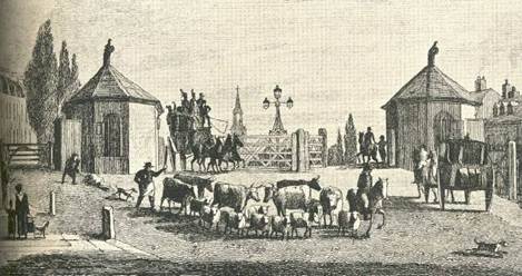
Despite the parish levies, by the beginning of the eighteenth century roads were still sometimes so difficult that travellers were known to break through the hedge and drive across an adjacent field rather than risk getting stuck. Indeed, in some places enterprising farmers created their own gates to bypass the worst sections, posting men at the gates to collect a 'voluntary' toll. These examples together with the Parliamentary precedent on the Great North Road referred to above stimulated the development of toll roads known as Turnpikes, allegedly named from the military practice of sentries blocking the way with their pikes, which were 'turned' aside to let people through on delivery of the correct password or toll.
The coming of gated turnpikes slowly began to improve the quality of the road network. The idea was that the fees would be used to pay contractors who would build a proper modern road and keep it maintained. Everyone would benefit eventually, and once the road was finished the fees could in principle be reduced to a much lower level, just sufficient to pay for occasional repairs.
The obligation of parishes to continue their contributions towards keeping the road maintained (the so-called Statute Duty) did not stop when the road was turnpiked. Yet despite the obvious objection that the first travellers would be paying out good money to drive on the same bad road, turnpikes became a success. They were the direct cause of many of
The initial Turnpikes were set up and administered through local Justices of the Peace, but the initiative only really took off when access was thrown open by an Act of Parliament in 1706 allowing anyone with money [or the ability to borrow it] the opportunity to specify and operate a toll road. A proposal to turnpike a particular section of road was normally a local initiative and a separate Act of Parliament was required to create each one. By 1730 Herefordshire had the largest turnpike network in
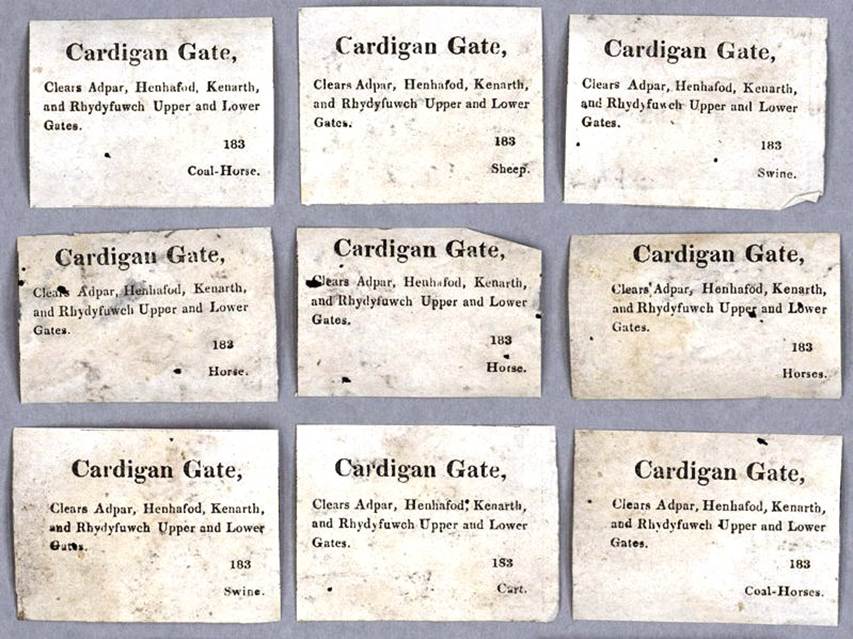
The new rules allowed any aspiring entrepreneur to apply to Parliament for permission to improve a section of road. Once Parliament had approved this by passing an Act, the road was effectively privatised as a 'Turnpike Trust' for a period of typically 21 years. The new owners were allowed to set up a gate (or sometimes just a chain barrier) at each end of the section and charge all travellers who passed through it. The Act gave a maximum toll allowable for each class of vehicle or animal - for instance one shilling and six pence for a coach pulled by four horses, a penny for an unladen horse and ten pence for a drove of 20 cows. The trustees could also call on a portion of the statute duty from the parishes, either as labour or by a cash payment. The trust used the income to pay for labour and materials to maintain the turnpike, but were also able to mortgage future tolls to raise loans for new structures and for more substantial improvements to the existing highway. Local gentry, clergy and merchants were typically nominated as trustees and usually appointed a clerk, a treasurer and a surveyor to actually administer and maintain the highway. These officers were paid by the trust. Trustees were not paid, though they derived indirect benefits from the better transport, which improved access to markets and led to increases in rental income and trade.
|
| |
| Examples of Toll Gate tickets for different categories of road users, c.1830 |
|
In the second half of the 18th century, turnpike trusts proliferated, facilitated by the ability to use mortgages to fund the work. By 1821 there were 18,000 miles of turnpike roads in
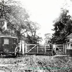
The trusts applied some of their funds to erecting tollhouses that accommodated the pikeman or toll-collector beside the turnpike gate. Although trusts initially organised the collection of tolls directly, it became common for them to auction a lease to collect tolls. Specialist toll-farmers would make a fixed payment to the trust for the lease and then organise the day-to-day collection of the money, leaving themselves with a profit on their operations over a year. This opened the door to malpractice and exploitation of travellers and tradespeople, which would lead in some cases to serious unrest from those who saw it as a form of legalised highway robbery.
|
|
|
|
|
|
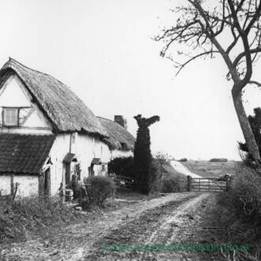
| Toll Houses and Turnpike Gates | |
However, when it came to the roads themselves the trusts did for the most part do the job properly. They engaged engineers who actually knew how to build roads, brought in labour and materials, hired surveyors, and even bought land in some cases when a different route would be better. They also settled long-running debates about the best structure and profile for roads, which led to the setting of construction standards that transformed the muddy quagmires into properly surfaced and drained roads that could withstand an English winter. Many of these standards echoed the Roman techniques of the past and still inform road building practices to the present day.
The financial operation of the Turnpike Trusts was deceptively simple. Their income from the tolls was used first to pay the interest on their debts, and all the money left over went into maintaining and improving their roads. The trustees, unlike the toll collectors who bought the leases, were not allowed to make a profit. In reality however this concept was flawed. Parliament usually fixed upper limits for the tolls which were insufficient to pay for the work actually needed to bring the roads up to the required standard, so that the initial debt was rarely paid off, This forced the majority of trusts to go back cap in hand at the end of the original term and ask for an extension to the time limit on their monopoly, usually citing the need to pay off the debts incurred in repairing damage caused by a rising volume of traffic, or in building new sections of road. When Parliament refused, as it frequently did, the trust would usually be wound up without repaying its original investors. This left powerful groups of people out of pocket and disenchanted with the turnpike system, which along with the growing numbers of travellers who resented paying tolls stored up considerable problems for the future.
The Acts for these new trusts and the renewal Acts for the earlier trusts also gradually incorporated a growing list of powers and responsibilities. From the 1750s, trusts faced increasing legal impositions such as erecting milestones indicating the distance between the main towns on the road. Travellers were also obliged to follow statutory rules of the road, the forerunner of the modern-day Highway Code. The trusts in addition were given considerable freedom to specify and enforce their own regulations, and impose severe penalties for infractions.
|
|
Trusts could take additional tolls during the summer to pay for watering the road in order to lay the dust thrown up by fast-moving vehicles. Parliament also passed a few general Turnpike Acts dealing with the administration of the trusts and regulation of traffic such as restrictions on the width of wheels - narrow wheels were said to cause a disproportionate amount of damage to the road.
The 1757 Turnpike Act amended and reduced into one act the laws in force for regulating the turnpike roads. All over the country property owners were tabling plans to upgrade stretches of public highway that crossed their estates and sought to set up tollgates and charge fees. Typical fees were one penny for a horse, three pence for a coach and four to six pence for a heavily loaded cart.
The rate at which new trusts were created slowed in the early 19th century but the existing trusts were making major investments in highway improvement. By 1838 the turnpike trusts in
|
|
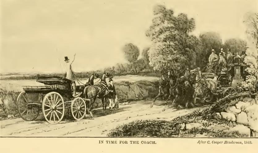
The quality of early turnpike roads was varied, and although turnpiking did result in some improvement, the technologies used to deal with construction, drainage, and the effects of weather were all in their infancy. However, as the industrial revolution and the associated growth in trade and travel gathered pace in the eighteenth and nineteenth centuries the demand for better roads led to rapid engineering innovation that transformed the network; the engineering work of Telford on the Holyhead Road (now the A5) in the 1820s, for example, reduced the journey time of the London mail coach from 45 hours to just 27 hours, and the best mail coach speeds generally doubled to the previously unimaginable heights of 10 miles per hour.
|
|
|
|
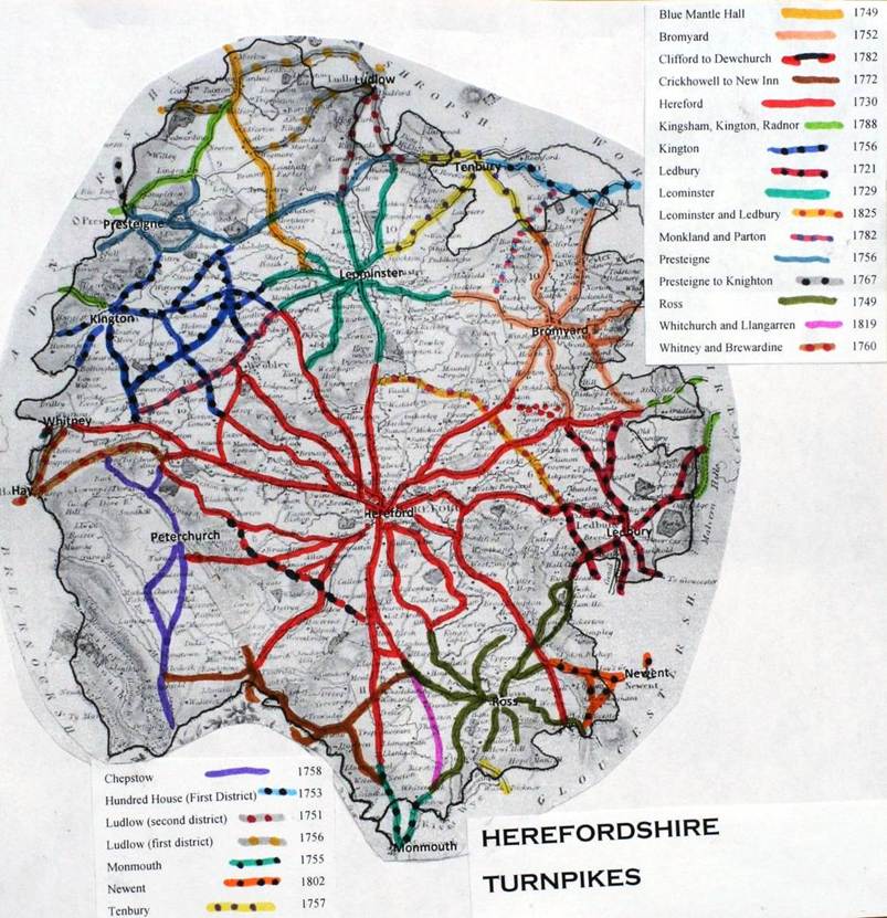
The legacy of the turnpike trusts is the network of roads that still form the framework of the main A and B road system in Britain. Their legacy in the country lanes and by-ways of Ewyas Lacy is somewhat less dramatic, however. Here most of the roads remained the old muddy tracks, although several turnpikes were established in the nearby
Turnpike Gates in Ewyas Lacy and the
| Civil Parish | Road Class. Number | GATE NAME | OS Grid Ref | Location (Name or Number | Road or Street |
| CLEHONGER | B4349 | | SO45913778 | W of |
|
| BREDWARDINE | B4352 | Bredwardine | SO3299344871 | Toll Gate Cottage | open road, |
| BREDWARDINE | B4352 | | SO3363144755 | Bridge Cottage (Toll Gate Cottage) | W side of bridge |
| LONGTOWN | UC road | Bryn | SO34202940 | |
|
| MADLEY | B4352 | Chilstone | SO39443904 | now Turnpike bungalow at jct for |
|
| CUSOP | B4350 | Coopers' Hall | SO23064277 | Coopers Hall |
|
| EWYAS HAROLD | B4347 | Ewyas Harold | SO392285 |
|
|
| CUSOP | B4348 | Nant y glaster | SO2334942252 | Tollgate Cottage | Cusop Dingle |
| VOWCHURCH | B4348 | Vowchurch | SO3935 |
|
|
| Table extract from http://www.turnpikes.org.uk/ | |||||
A map by Alan Rosevear of Herefordshire Turnpikes suggests that the route between Pandy, Michaelchurch Escley and Vowchurch was also turnpiked at least in part, and fresh evidence of this has recently emerged.
|
|
| Map by Alan Rosevear: www.http://turnpikes.org.uk/. |
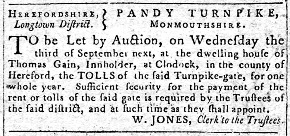
Further research by Martin Cook of the Longtown and District Historical Society has cast additional light on activities by a Turnpike Trust in the Longtown District of Ewyas Lacy between 1788 and 1820, and its operation of the highway from Pandy through Longtown to Michaelchurch Escley and Vowchurch in particular. A press cutting from 1788 shows that a turnpike was operating in the district of Longtown, with the tolls of the Pandy Turnpike Gate being let by auction on the premises of Thomas Gain, Innholder at Clodock.
|
|
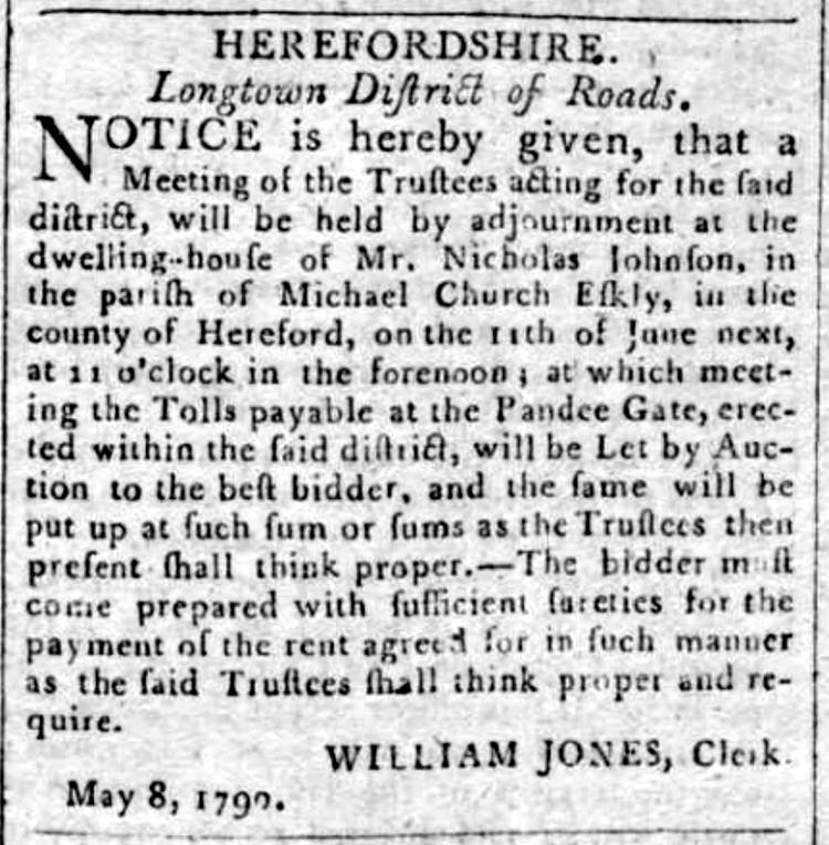
The trustees acting for the Longtown District of Roads also met in Michaelchurch Eskley in 1790, where the tolls payable at the 'Pandee Gate' were again let by auction.
|
|
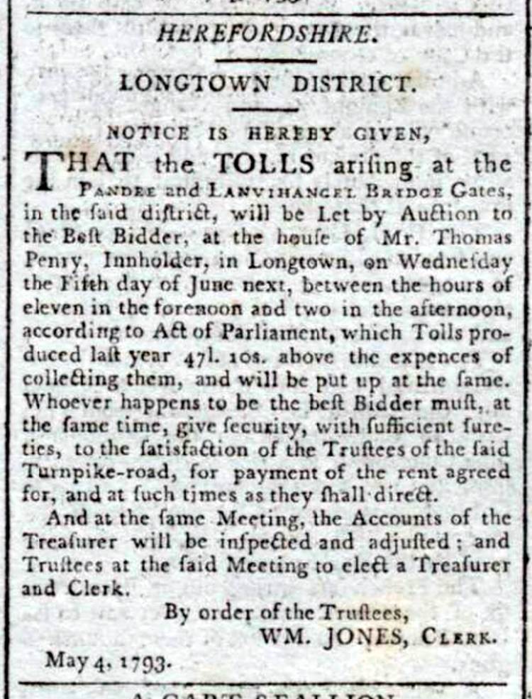
By 1793 a second gate had been put in place, with tolls at the Pandee and Llanvihangel Bridge Gates in the Longtown District put up for auction on the premises of Thomas Penry, Innholder in Longtown,, accompanied by the claim that in the previous year the tolls had produced the sum of £47.10s. 'above the expenses of collecting them'. In a relatively poor and sparsely travelled area, this would have represented a substantial burden on the local economy.
|
|
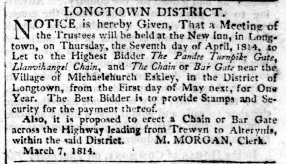
By 1814 the scope of the turnpike had expanded yet again, with the trustees offering by auction at the New Inn in Longtown the tolls from the Pandee Turnpike Gate, the Llanvihangel Chain, and a Chain or Bar Gate near the village of Michaelchurch Eskley. A further Chain or Bar Gate across the highway from Trewyn to Alterynis in the Longtown District was also proposed, adding yet more to the costs of travel for local people.
|
|
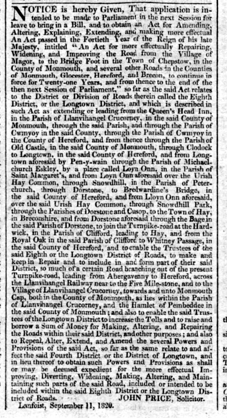
By 1820, however, it seems that the Longtown District may have been encountering the same financial problems as the rest of the Turnpike Trusts, and the trustees were intending to apply to Parliament for an Act to extend their remit for a further 21 years, to raise higher tolls and to extend their borrowing powers. The full extent of Turnpiking in the Ewyas Lacy and Golden Valley area by that time is not entirely clear, but reference is made to the roads there within the jurisdiction of the Longtown District in the 1820 press notice regarding the Act as follows:
?the District or Division of Roads called the Longtown District is described in such Act as extending or leading from the Queens Head Inn in the parish of Lllanvihangel Crucorney, and through the parish of Cwmyoy, and from Longtown aforesaid to Pen-y-wain through the parish of Michaelchurch Escley, by a place called Loyn Onn in the parish of Saint Margarets and from Loyn Onn aforesaid over the Urish Hay Common, through Snowdhill in the parish of Peterchurch, through Dorstone to Bredwardine's Bridge... and through the parishes of Dorstone and Cusop to the Town of Hay, and from Dorstone aforesaid through the Bage to join the Turnpike Road at Hardwicke in the parish of Clifford leading to Hay.
|
|
Trade and travel in the 18th & 19th Centuries
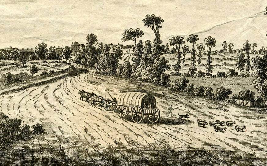
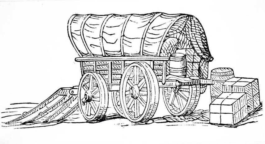
Substantial investment in the road infrastructure and improved road construction methods through the Turnpike Trusts helped sustain a boom in trade and travel during the eighteenth and early nineteenth centuries that was fuelled by the burgeoning industrial revolution. Massive commercial 'stage waggons' could reliably carry goods across a country-wide network of routes in much greater quantities and at a fraction of the cost of the old pack-horse trains. Here too the technology was developing; purpose-built waggons could carry loads of up to eight tons and ran on wheels with rims anything from nine to sixteen inches wide with sixteen-inch hubs.
|
| |
| Print by WH Pyne: Science Museum Group Collection |
|
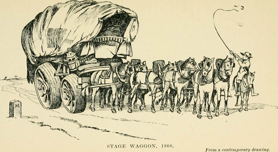
Wheels of this size were needed to cope with the severe jolting caused by roads that were still often uneven, and were also intended to reduce the damage to still-fragile road surfaces that remained vulnerable to ruts and potholes. To further limit potential damage, the waggoner was required to walk or ride beside the lead horse to keep the speed down and could be heavily fined for riding on the waggon. Freight charges varied between one shilling and sixpence to 2 shillings per hundredweight and passengers who could not afford the stage-coach fares sometimes travelled under the canvas cover amongst the bales of freight. A web of stage waggon routes covered the country, with staging posts to change the horses.
An extract from an advertisement in the Hereford Journal of 18 January, 1809 indicates the scope of the network and the time the waggons spent travelling from London:
The proprietors of the Cambrian Waggon Company beg leave most respectfully to inform the public that they have established a regular conveyance to and from London, Oxford, Cheltenham, Glocester, Worcester, Manchester, Liverpool, Leeds, Halifax, Saddleworth, Huddersfield , Wakefield, Sheffield, Birmingham, Ludlow, Chester, Shrewsbury and all parts of the North of England and Scotland, for Herefordshire , Monmouthshire and all parts of South Wales and the South of Ireland.
THEIR
From the Cambrian Warehouse, Bell Inn,
Pack Horse Inn, Worcester Tuesday night; Cambrian Warehouse Bromyard Wednesday morning; Hereford Thursday morning; Hay Thursday night; Brecon Sunday evening; Llandovery Monday morning; Llangattock Monday noon; Llandilo Tuesday morning and arrive at Carmarthen Tuesday Noon, from whence all goods for Cardiganshire, Pembrokeshire and the south of Ireland will be regularly forwarded.
THE WAGGON RETURNS
From the Cambrian Warehouse Carmarthen Wednesday noon ... [and] arrives at the Pack Horse Worcester Tuesday morning and at the Bell Inn, Smithfield London Saturday morning.
All goods intended for this conveyance from Manchester, Birmingham etc. are particularly requested to be directed and forwarded by Twiss from Manchester and Stockall from Birmingham to the Pack Horse at Worcester and also from Glocester and the clothing country, by Page, to the Cambrian Warehouse Hereford.
THEIR
From the Moderator warehouse
RETURN
from the Cambrian Warehouse Brecon on Saturday evening; Abergavenny Sunday night and arrives at Newport on Monday Morning, when all goods for Bristol, Bath and the West of England will be regularly forwarded by the Moderator boat to Bristol and from thence by the different carriers.
The distribution of goods onward from the warehouses serviced by these stage waggons remained a rather chancier business, using smaller wagons and carts that still had to struggle over largely unimproved by-roads despite the efforts of the parishes to improve matters.
|
|
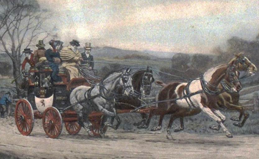
Stage coaches too carried mail and increasing numbers of passengers around the country on a regular fixed timetable and at unprecedented speeds - albeit with some degree of discomfort especially for those passengers opting for the cheaper outside berths. As with the trade waggons, an extensive network of coaching inns grew up to provide facilities for changing horses and seeing to the needs of the coachmen and passengers at the stops. Many of these still survive in market towns and cities up and down the country.
|
|
|
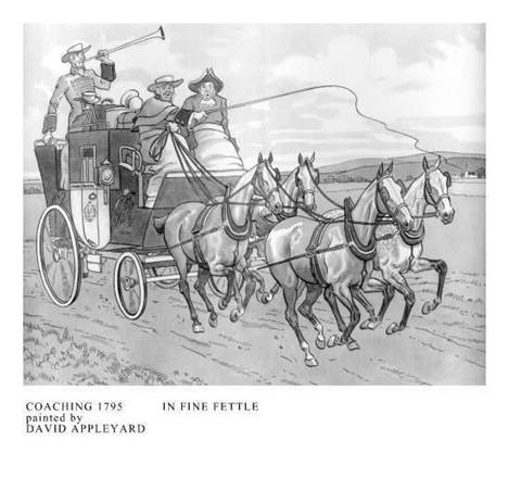
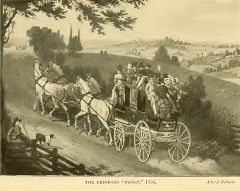
As an indication of how the stage coach system operated, in 1808 Broome, Whitney and Co. operated a twice-weekly service from
The fact that this journey took up to 8 hours also tells us that the stage-coaches travelled at an average of only about 7 miles per hour at least on this route, which was probably not untypical. A coach with a relatively light load of passengers and luggage and a team of four or six horses was capable of much faster speeds on a good road, and this gives an indication of how poor the main roads still were in our area despite the best efforts of the parishes and the Turnpike Trusts.
Beneath the surface however there were also much more fundamental problems with the turnpike system in general. From the outset there had always been a small but energetic minority who were not prepared to put up with tolls, which they considered an outrageous tax upon their freedom of movement. This was not an age when protest was peaceful, and on occasions armed bodies of men assembled to destroy the turnpikes, burn down the toll-houses and blow up the gates. The resistance was the greatest along the line of the Great North Road, but even in Herefordshire the way that towns were surrounded with toll gates created unrest as it meant produce became significantly more costly to bring to market.
The poor resented higher market prices just as much as the farmers resented paying the tolls that significantly disrupted their trade, and sympathetic locals began to support the turnpike raiders and offer their assistance as look outs. The situation became so serious that the government passed an Act of Parliament in 1734 which mandated the death penalty for those who destroyed turnpikes, but even so the lawbreaking continued. Matters were not improved by the increasing numbers of influential investors angered by losing their money when Trusts failed.
The eventual demise of the turnpike system, however, was not due to such protests. It was the coming of the railways that spelt disaster for most turnpike trusts, and it was one that struck very rapidly. The first purpose-built passenger railway, the
The knock-on effects saw the toll revenues of most turnpike trusts fall by half or more in the space of less than forty years. In many cases this meant they could no longer pay the interest on their loans, let alone invest in road maintenance and construction. The debts of many trusts became unsustainable and forced mergers of solvent and debt-laden trusts became frequent. By the 1870s Parliament stepped in and began to close trusts where this could be done without leaving an unacceptable financial burden on local communities. From 1871, all applications for renewal were sent to a Turnpike Trust Commission which only allowed existing Acts to continue on condition that their primary objective must be to discharge the debt, and return the roads to local administration. When a trust was ended, there were often great celebrations as the gates were thrown open. The assets of the trust, such as tollhouses, gates and sections of surplus land beside the road were auctioned off to reduce the debt, and mortgagees were paid at whatever rate in the pound the funds would allow.
The end of the turnpike era finally came in 1888 when a Local Government Act was passed that gave responsibility for maintaining main roads to county councils and county borough councils. This was perhaps an improvement on the old parish-based arrangements but still begged the question of where the money would now come from to continue maintenance and development of the road network. As the twentieth century dawned this issue was thrust onto the political agenda of central government by yet another technological and transport revolution - the advent of the internal combustion engine.
Foundations of the modern road network
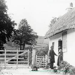
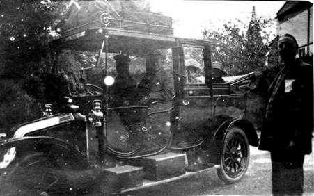
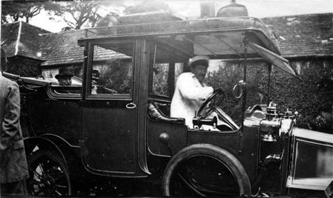
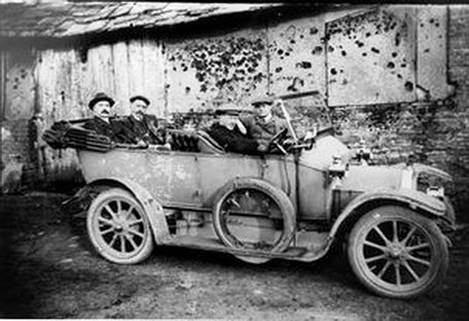
Motoring came to Ewyas Lacy in the early 1900s, and it appeared as you might expect in the hands of the wealthy. The local roads may not have improved much, if at all, but prestige apart a motor car had some practical attractions. It was instantly available when required and offered a ride considerably faster and more comfortable - if still potentially rather less reliable - than horseback, pony and trap or coach. It wasn't just the cost that made motoring the preserve of the privileged few, however. A whole new set of skills and services had yet to be developed to support motorists, from the basics of learning to drive the machines to the mechanics of their maintenance and repair. Even obtaining the fuel for them was far from straightforward; petrol was only permitted to be sold in cans, which had to be specially ordered. For the gentry who could afford this novel form of transport there was no question of getting their own hands dirty, and so chauffeurs had to be employed to drive and maintain the cars in much the same way as grooms and stablemen had traditionally looked after the horses and carriages.
|
|
| |
| Early motoring at Michaelchurch Court |
| |
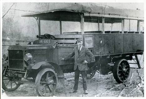
The First World War saw huge technological progress that transformed motor vehicles from playthings of the idle rich to everyday workhorses accessible to large numbers of people. After 1918 when the war ended surplus armed forces vehicles became widely available and were pressed into civilian service as buses and lorries. These offered a range and flexibility of cheap local services for passengers and freight that the railways struggled to match. Just as the railways had put the stagecoaches, stage waggons and turnpike trusts out of business in their time, now the internal combustion engine threatened to do the same to the railways - if the roads could be improved sufficiently to accommodate the traffic. The story of the Golden Valley Branch of the Great Western Railway , told elsewhere on the History of Ewyas Lacy website, illustrates the speed and severity of the impact on the railways which was perhaps even greater in such relatively remote rural areas where their profitability had long been marginal.
|
|
| ||
| Passenger Bus c. 1920 | Freight Lorry c. 1920 |
| |
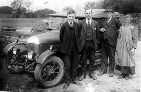
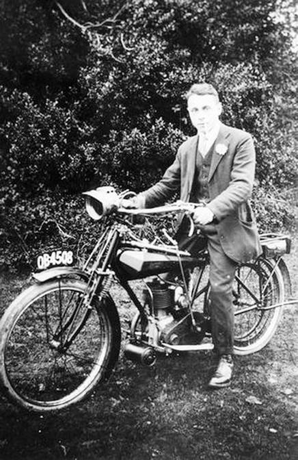
Motor bikes and motor cars also gradually became affordable for a much wider range of people, adding to the rapidly growing demand for better quality roads to which the local authorities were unable to respond effectively. In 1895 there were less than 100 motor cars in the
By the beginning of the twentieth century many main roads had been 'macadamised' by surfacing them with broken stone. While ideal for horses' hooves, which could find a firm foothold in both dry and wet conditions, faster moving motor vehicles threw up clouds of dust in dry weather, and sprayed a noxious mud of horse droppings mixed with urine and rain when wet. Road safety issues arose too; higher speeds and slippery surfaces led to accidents, and the noise from motor engines caused horses - still the predominant form of transport - to panic.
The problem of dust and mud was solved in 1902 by the invention of an all-weather road surfacing material called 'tarmac' made from mixing asphalt with ironstone slag. When laid, the new material not only acted as a sealant but also provided better grip for motor vehicles to reduce the risk of skidding. But this came at a cost. Once again the problem of funding road improvements landed on the plate of central government, and this time they could not duck the issue, though it would be many years before most roads had been 'tarmacadamised'.
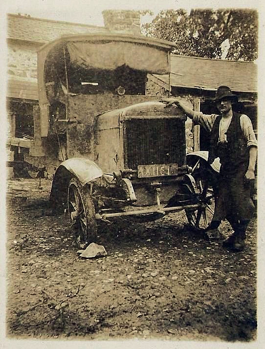
Road safety issues too had to be addressed. The 1903 Motor Car Act introduced the crime of reckless driving and imposed penalties. Road vehicles had to be registered and licensed, with number plates showing their registration numbers, and a national speed limit of 20 mph was imposed with local limits imposed by county councils as necessary. Vehicle drivers had also to be licensed, the minimum qualifying age being 17 years. This was just the beginning of a long process of imposing ever more stringent motoring rules and regulations; strangely, however, statutory roadworthiness checks on vehicles were not introduced until much later despite the rising numbers of vehicles that were manifestly unsafe to be on the roads.
|
|
| A dilapidated lorry in the |
Around the same time the first serious new steps were taken to raise money for road improvements. It was generally agreed that road users should bear at least a portion of the cost, but no one wanted to return to toll-gates as a means of raising revenue. The solution adopted was to introduce a graduated tax on cars based on engine power and to impose a tax on petrol. The Roads Act of 1920 extended these powers and created the Road Fund for revenue from excise duty on road vehicles and from the sale of licences. A new Ministry of Transport was also created, which devised a classification system for important routes and provided grant funding from the Road Fund to County Councils to improve these newly defined 'trunk roads' as part of a wider scheme to relieve unemployment after the end of the war. Then in 1930 responsibility for all roads was vested once more in the County councils, but this time with central government providing further money from the Road Fund. Finally, resources began to trickle down to the countryside by-ways.
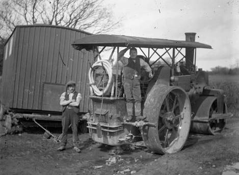
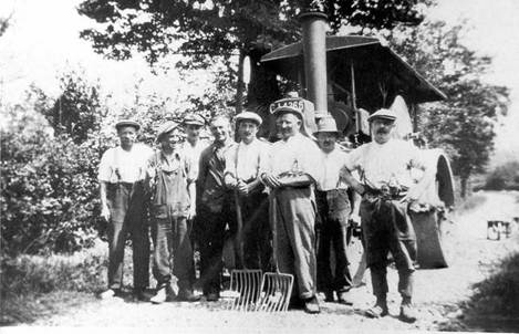
In Ewyas Lacy this was a time when 'Road Gangs' or 'Lengthsmen' first started to appear to maintain and improve appointed parts of the network of lanes, equipped with heavy machinery more suited to the task than the picks, shovels and occasional unskilled labour of past centuries.
|
|
|
|
|
|
| The Road Gang at | |
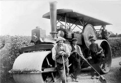
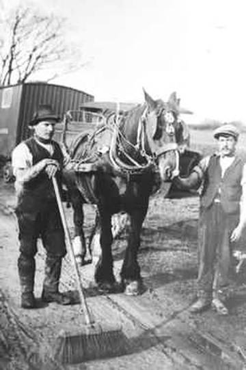
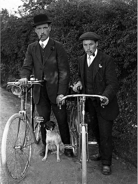
The new-fangled tarmacadam surfaces were still too much to expect, but steamrollers made short work of ruts and potholes. They also rolled gravel or quarry waste into the earth tracks to provide a more enduring finish that opened them up to motor vehicles and gave them at least a fighting chance of remaining passable in the winter weather. Parish council minutes from the period show that potholes remained a perennial source of local complaint - some things never change - but finally motorists and even cyclists could get to places previously only accessible on horseback or [with luck] by the traditional pony and trap. For the rich, like the Lord of the Manor of Ewyas Lacy, this encouraged the purchase and racing of a succession of faster, more powerful vehicles simply for the fun of it, as described in the website article on Randolph Trafford's cars . For ordinary folk, however, it opened up more fundamental new horizons.
|
|
|
|
|
|
| Travelling in Ewyas Lacy in the 1920s and 1930s | |
The effects were profound and not just on the ability of local people to get around the area. Historically the difficulty of travel had led to local economies being largely self-sufficient, with a wide range of trades and professions from blacksmiths and wheelwrights to tailors and shoemakers enjoying an effective monopoly in small businesses close to their community centres.
|
|
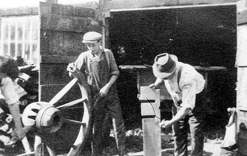
|
| Wheelwrights in the | Clogmakers in the |
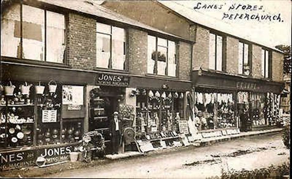
As the roads improved and transport that was both affordable and relatively quick became available finished goods of all sorts could be brought into villages from cheaper sources. Over a short period of time large parts of a rural economy that had persisted for centuries vanished as many of those traditional local tradesmen were put out of business by village shops. As early as 1912, for instance, the once sleepy high street of Peterchurch in the
|
|
| |
The remoter villages and hamlets in Ewyas Lacy could not boast shops on this scale, but even there many entrepreneurs took advantage of the new opportunities to open general stores. But these in their turn quickly faced an uphill struggle as car ownership and public transport grew apace and allowed local people to take their custom just as easily to nearby market towns where choice and prices were even better.
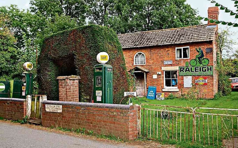
Alongside the shops, the opening up of the roads also allowed other new businesses to grow even as some of the older ones faded away. Motor vehicles needed fuel and maintenance, and one of the first of the new 'garages' in Herefordshire opened in the early 1900s at Vowchurch in the
|
|
| Wilding?s West End Garage |
About the same time other similar enterprises started around Ewyas Lacy, including Michaelchurch Escley where the blacksmiths shop at Crossways became 'Crossways Garage', servicing and repairing motor vehicles as well as serving as an outpost for a number of new public bus companies that had started up to serve the area.
Roads and their maintenance today
Despite the spate of government spending, by the 1930s the
The Second World War intervened before anything further could be done, but soon after it ended, the Ministry of Transport revived the programme. Legislation was passed in 1949 authorising the construction of 'special roads' but post-war austerity and materials shortages meant that it was not until 1955 that orders to build two small 'special road schemes' were made under the 1949 Act. The first major inter-urban motorway in
The rest of the modern motorway network followed, and the Department for Transport (formerly the Ministry of Transport) is still the government department responsible for planning and investing in the English transport infrastructure, including roads. It is supported by 20 agencies and public bodies, among which is the Highways Agency responsible for managing the core road network, routes that account for 34% of all road travel and 67% of lorry freight travel. Local authorities, with support from central government funding, maintain the remaining minor roads.
In Ewyas Lacy the eventual availability of proper funding after the Second World War meant that for the first time the network of roads and lanes could be surfaced with tarmac and travel was no longer so subject to the vagaries of the weather. It also meant that the local road gangs of the past were largely replaced by County-wide teams periodically conducting major repairs and resurfacing works with much more sophisticated equipment.
|
|
|
|
|
|
|
|
|
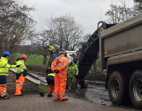
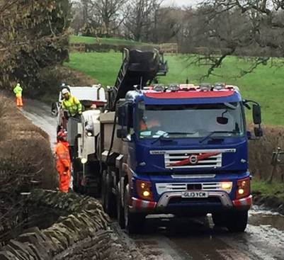
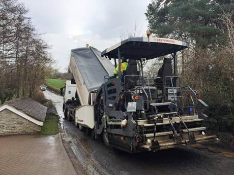
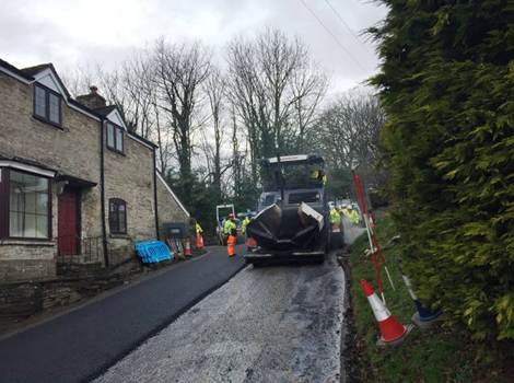
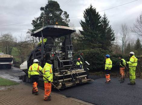
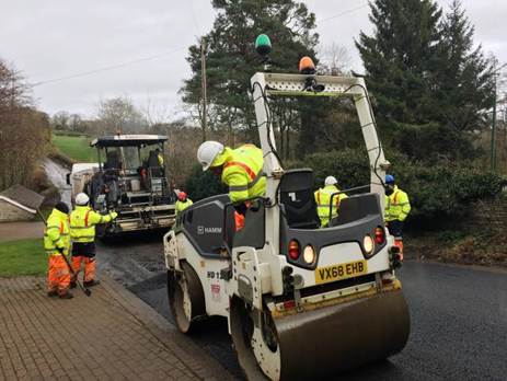
| The 'Road Gang' resurfacing the road in Michaelchurch Escley, 2022 | |
Similar area teams were equipped and put in place for routine road maintenance to fill potholes, clear ditches and culverts and patch damaged areas. In recent years some minor highway works have also been devolved once again to parish councils in Ewyas Lacy, with the County providing them with a budget to employ a local contractor known, in a nod to the past, as the Lengthsman. Works carried out by lengthsmen can range from clearing minor storm debris discharged onto the highway, clearing clogged drains, cutting back overgrown hedges and verge cutting as required by the parish, taking advantage of local knowledge of trouble spots.
The history of Ewyas Lacy is in many respects written in our roadways. Every twist and turn of the road, every neglected footpath, overgrown green lane or sunken track tells a story of long-ago places and the people who lived in them and travelled between them. Some of those stories are now lost in the mists of time; others can still be discovered, if sometimes dimly, in the historical records. Some we simply take for granted as we drive on our tarmac roads hurrying about our business or pleasure in the modern world. But all of them connect us with past lives, communities and values that, although very different from our own, shaped the environment we enjoy today.
Ref: rs_ewy_0350