
Held at: | Private collection |
Reference: | gc |
Source: | Original research |
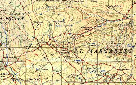
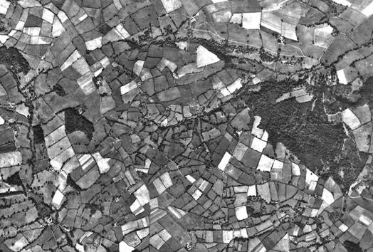
Title: | Upper Maescoed, Map and Aerial photograph |
Place name: | St Margarets |
Date: | 1947 |
Description:
The Upper Maescoed, an old open common which became filled with small land holdings granted by the Steward of the Marques of Abergavenny; mainly in the 18th century
|
A modern map of the area shown in the Aerial Photograph |
|
note the cluster of small holdings |
Observations:
Aerial photograph taken by the RAF on the 2nd October 1947
Ref: gc_stm_2005