
Held at: | Private collection |
Reference: | gc |
Source: | Research on Tithe Map schedule |
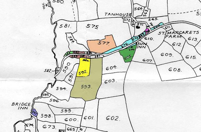
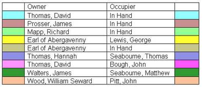
Title: | Some Land owners in part of St Margarets, Map 11 |
Place name: | St Margarets |
Date: | 1844 |
Description:
Some properties and their owners in part of St Margarets at the time of the Tithe map of 1844
Holding | Owner | Occupier |
2 Houses [Sun Inn] | David Thomas | In Hand |
House [Lower Rock] | James Prosser | In Hand |
Land (plot 583) | Richard Mapp | In Hand |
Land (plot 592) | Earl of Abergavenny | George Lewis |
Land (plot 593) | Earl of Abergavenny | In Hand |
House [Bridge Inn] | Hannah Thomas | Thomas Seabourne |
House (plot 568) [The Fountain] | David Thomas | John Bough |
Land (plot 605) | James Walters | Matthew Seabourne |
Land (plot 577) | William Seward Wood | John Pitt |
----- |
|
|
Part of cottage (plot 588a) | James Lewis | In Hand |
Plot 577 is part of a property shown on map 11
Plot 588a is part of plot 588
|
to see associated maps click here
Observations:
None
Ref: gc_stm_3011