
Held at: | Private collection |
Reference: | Research by nw,gc & tg |
Source: | Tithe Maps and Apportionment Schedules |
Title: | Owners and Occupiers of land in Ewyas Lacy |
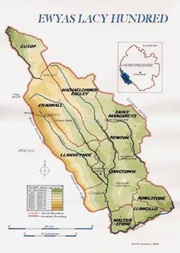
Place name: | Ewyas Lacy |
Date: | 1840’s |
Description:
The owners and occupiers of all holdings in the parishes of Ewyas Lacy have been extracted from the Schedules which accompany the Tithe maps held at the Hereford Record Office.
For each parish, a separate full listing gives the names of all owners with the corresponding occupier and size of holding in acres; and map extracts locate and identify each holding.
Click below for details
Craswall Upper and Lower
|
|
|
Observations:
For background information on the Tithe Survey in Ewyas Lacy parishes, click here
Ref: nwgc_ewy_3000