
Title: | Digital Archive: Olchon Development Project - Field Name Survey |
Date: | 1999 |
Olchon Development Project - Field Name Survey and the 1840s Tithe Survey
By Nina Wedell
This survey forms part of the material for the Olchon Development Project, whose brief was
“to create an information base and recommendations for the development of sustainable economic regeneration and landscape/ wildlife protection and enhancement in the Longtown Group of parishes comprising Craswall, Llanveynoe, Longtown with Clodock, and Walterstone”
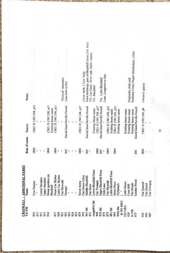
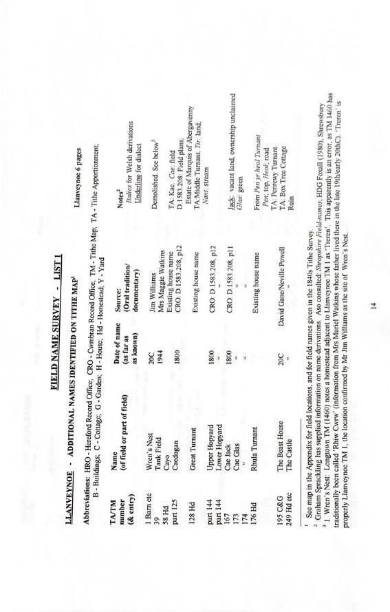
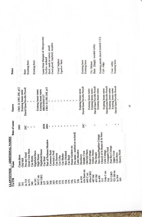
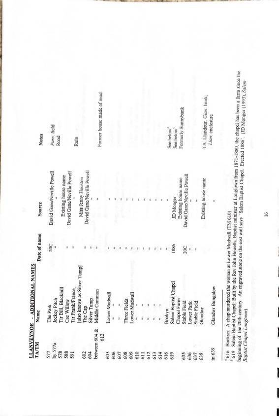
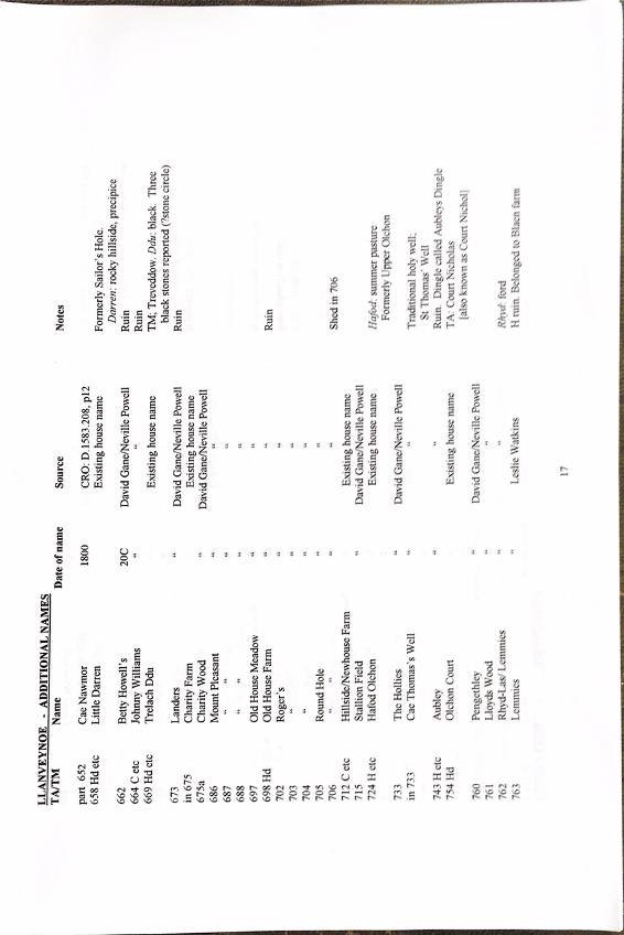
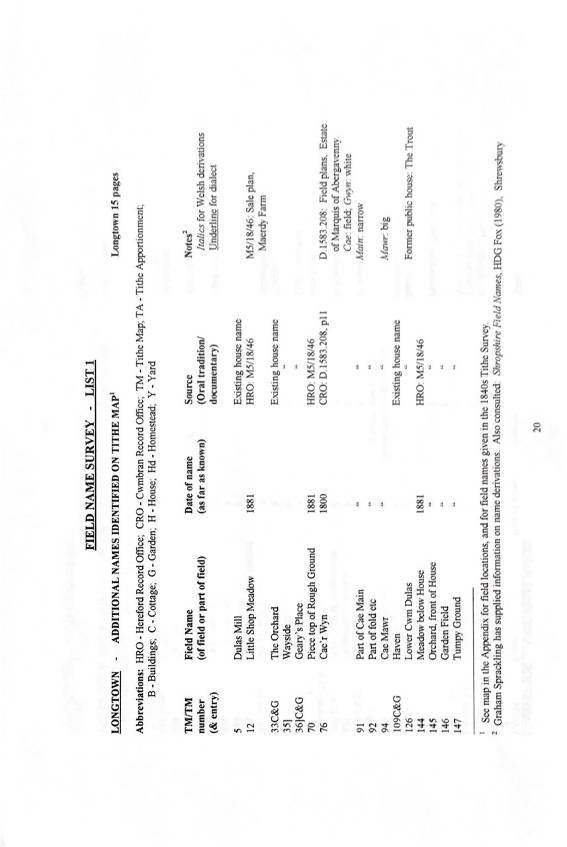
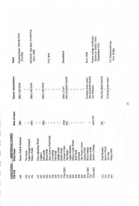
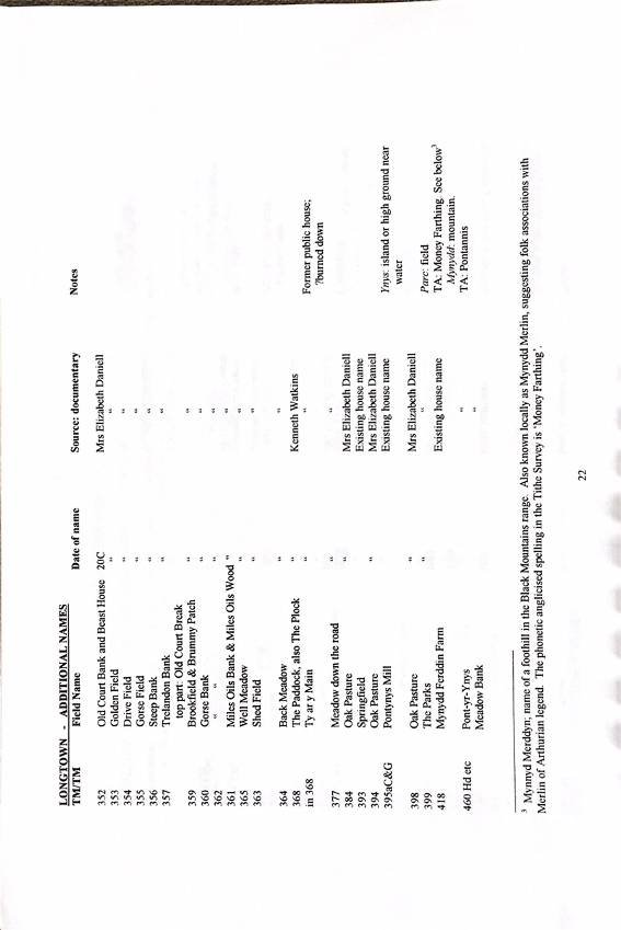
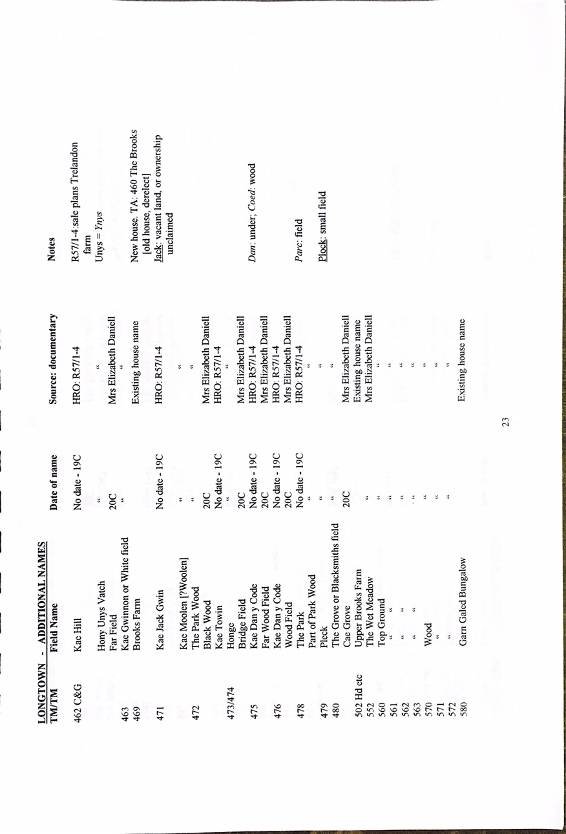
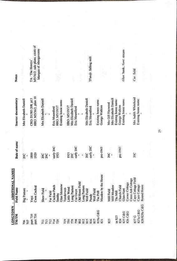
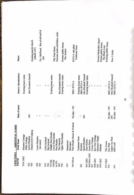
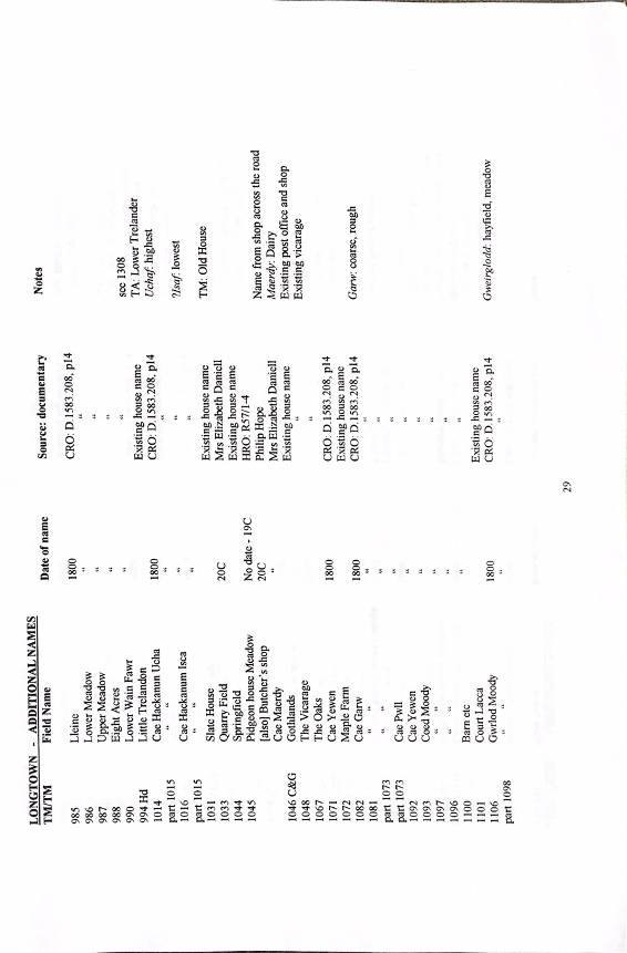
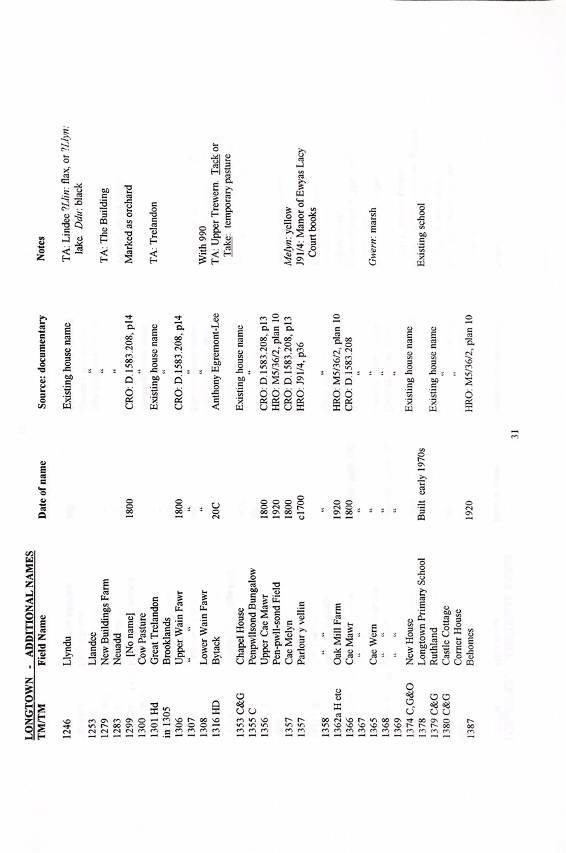
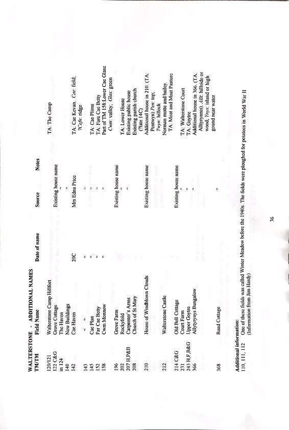
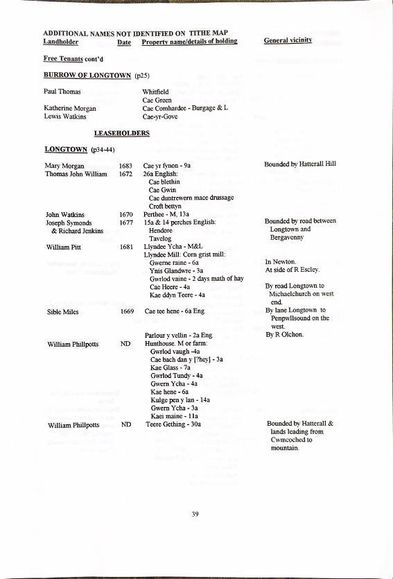
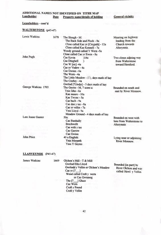
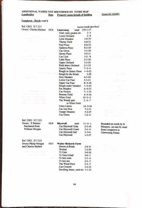
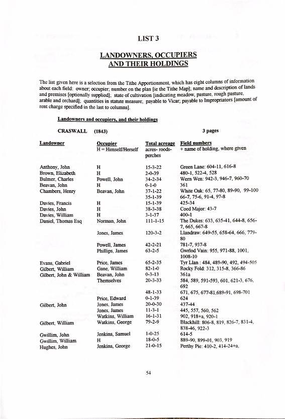
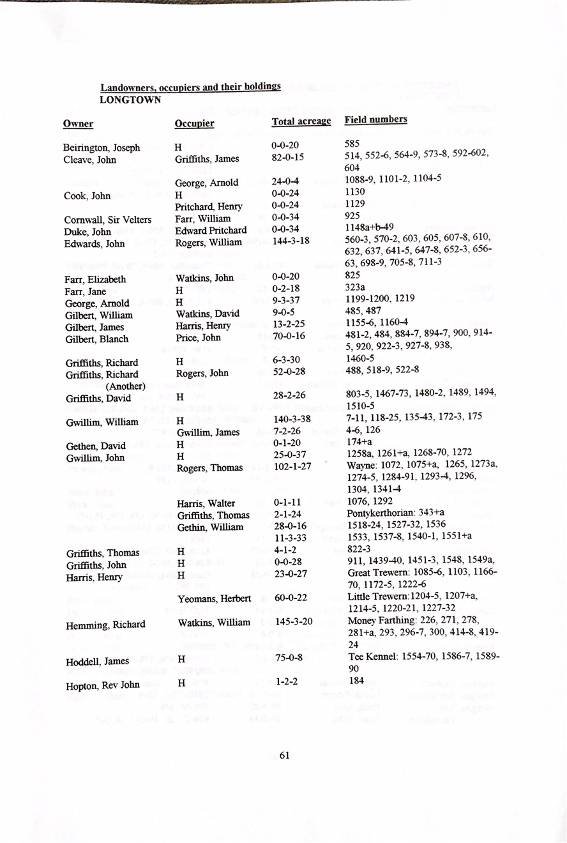
The field name survey is centred around the Tithe Survey of land use and ownership conducted throughout England and Wales between 1836 and 1846, which consisted of a Tithe Map showing fields and houses and a Tithe Apportionment listing names of owners and occupiers together with the identification of field and house names, acreages and rents payable. A wide range of other sources is then drawn on to supplement that information with names and relevant detail from other periods of time.
The overall summary report for the Olchon Development Project is available in our digital archive. An index and links to digital archive copies of the five more detailed reports and eight Appendices that underpin it can also be found there.


Ref: rs_lon_0303